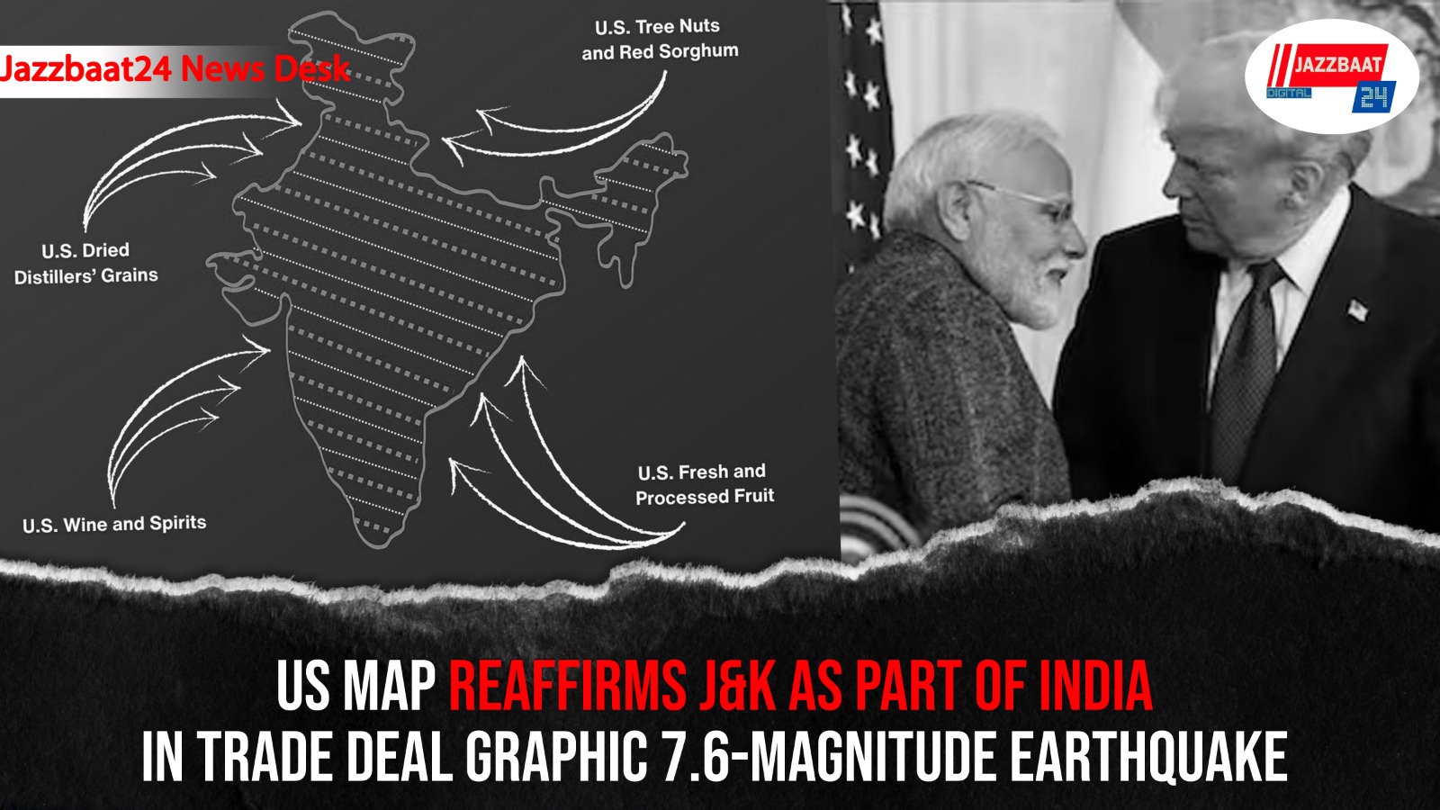
In a development that carries both diplomatic and symbolic weight, the United States Trade Representative’s (USTR) Office has released an official map of India showing Jammu and Kashmir including Pakistan-occupied Kashmir (PoK) as part of Indian territory. The graphic was shared as part of the India–US trade framework announcement, which outlines tariff reductions and a push towards a $500 billion bilateral trade target.
The map has drawn attention for its clear depiction of India’s political boundaries, a departure from the ambiguity often seen in international representations of the region. Indian officials and strategic observers view the move as a strong signal of Washington’s alignment with New Delhi’s long-standing position that Jammu and Kashmir is an integral part of India.
The development comes at a time when India and the US are recalibrating trade ties. Under the new framework, Washington has agreed to reduce tariffs on Indian goods to 18 per cent from 50 per cent and withdraw the additional 25 per cent duty. India, in turn, is set to lower or eliminate tariffs on several American exports, including tree nuts, agricultural produce, and select processed food items. The framework is aimed at easing trade friction and accelerating economic cooperation across key sectors.
For Pakistan, the USTR graphic is being seen as a diplomatic setback, particularly amid Islamabad’s recent outreach to Washington. Analysts note that while the US continues to engage Pakistan on strategic and economic interests, the latest move underscores the growing centrality of India in American geopolitical calculations in the Indo-Pacific and beyond.
Beyond trade numbers, the message is political: the visual affirmation of India’s territorial claims adds to the momentum of deepening India–US ties. As both countries move towards a broader strategic partnership, the episode reflects how economic agreements increasingly intersect with geopolitics, shaping regional narratives and power equations in South Asia.