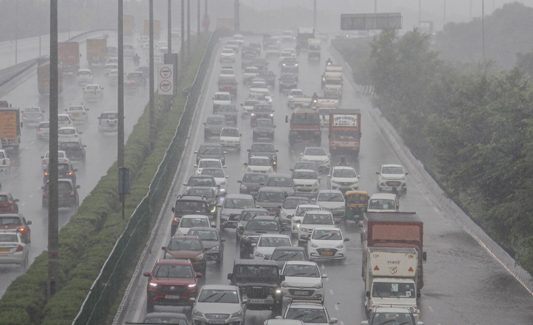
As of 8:30 am on Sunday, the national capital has seen the second-highest rainfall since 2007 during the previous 24 hours. The city survived the relentless rains, which totalled 74 mm by 8:30 on Sunday and reduced the highest temperature on Saturday by 10 degrees, almost setting a record-low difference between day and night-time temperatures.
The massive moisture infiltration from the Arabian Sea via Gujarat and eastern Rajasthan, reaching as far as Uttarakhand via the Delhi region, according to the meteorological official, is caused by the east wind phenomena. “But to hold a period of rain for up to two days, these winds have joined the Arabian Sea, and that’s what it is doing. From October to March, we normally have 3 to 5 such intense interactions, ”said an IMD official. The incessant rains for the second consecutive day in the capital of the country improved the air quality on Sunday to a “satisfactory” level.
The main meteorological station for the city, the Safdarjung observatory, recorded 74.3 mm of precipitation over the previous 24 hours. Rainfall totals at the Palam observatory were 64.9 mm. According to the India Meteorological Department (IMD), the Lodhi Road, Ridge, and Ayanagar weather stations recorded rainfall totals of 87.2 mm, 60.1 mm, and 85.2 mm, respectively.
Temperatures drop: A meteorological official said that the national capital's minimum temperature was 23.4 degrees Celsius, which is a little lower than the season's average.
Sunday weather forecast: On Sunday, the IMD is predicting a mostly overcast sky with light rain and isolated thundershowers. The highest temperature is probably going to be in the range of 24 degrees Celsius.


