New Delhi:
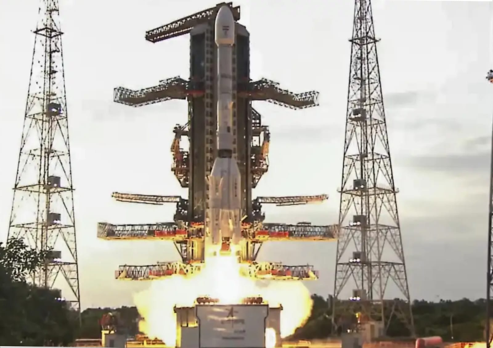
India and the United States successfully launched the NASA-ISRO Synthetic Aperture Radar (NISAR) satellite on 30 July 2025, marking a historic chapter in international space collaboration. Launched from the Satish Dhawan Space Centre aboard the GSLV‑F16 rocket, the $1.5 billion mission is the most ambitious Earth observation satellite project between ISRO and NASA.
The orbiter, weighing roughly 2,392 kg, carries dual frequency radar systems, NASA’s L‑band and ISRO’s S‑band, capable of penetrating clouds, rain, foliage, and darkness. This allows it to detect minute shifts in the Earth’s surface, down to one centimetre in size, enabling unprecedented monitoring of environmental changes, glaciers, land subsidence, and seismic activity.
ISRO’s share of the mission about ₹788 crore (circa $96 million) supports development of the S‑band radar, satellite structure, and launch, while NASA contributes approximately 80 % of the cost via its L‑band radar and payload systems. The mission is projected to operate for a baseline duration of three years, with possible extensions up to five, undertaking global coverage of Earth’s land and ice surfaces every 12 days, with average revisit every six days.
Officials say NISAR is equipped to support a broad range of applications, including flood and landslide forecasting, monitoring coastal erosion, tracking glacier and ice‑sheet dynamics, measuring ecosystem stress, and assessing carbon fluxes in forests and wetlands. ISRO will oversee satellite operations and command functions, while NASA will play a key role in orbit manoeuvre planning and radar operations; both agencies’ ground stations will process and make data openly available to scientists globally.
At launch, ISRO and NASA stated that NISAR represents a “game‑changing” advancement for Earth science, offering unprecedented resolution in observing changes across varied terrains. Gerald Bawden, NASA’s programme scientist, remarked that many researchers “don’t yet realise how much of a game changer NISAR is going to be”.
The satellite’s deployment also holds symbolic significance: it is the first NASA payload to be launched aboard India’s GSLV into a sun synchronous polar orbit, demonstrating India’s growing prowess in critical space missions. With a 12 metre diameter radar reflector that will unfold in orbit, NISAR will circle Earth at an altitude of approximately 747 km with an orbital inclination of 98.4°, covering nearly all terrestrial and polar regions.
India’s Minister of Science and Technology, Jitendra Singh, tweeted his congratulations, calling the mission a significant leap for Indian space capability. NASA’s science mission chief Nicky Fox described NISAR as “a first of its kind, jewel radar satellite” that will revolutionise how the planet is studied.
As the satellite begins its critical in‑orbit checkout phase, a process expected to take several weeks, its sensors, solar arrays, and deployment mechanisms will be tested and calibrated. Full scientific operations are scheduled to commence by late October 2025, with data dissemination to follow soon after.
Through NISAR, ISRO and NASA aim to bring about transformative improvements in global disaster preparedness, environmental monitoring, and scientific knowledge delivering advanced radar imagery freely to researchers, policymakers, and first responders worldwide.